


Mapping in Colombia – Paul Pacque
Posted on | August 1, 2013 | Category: Arena
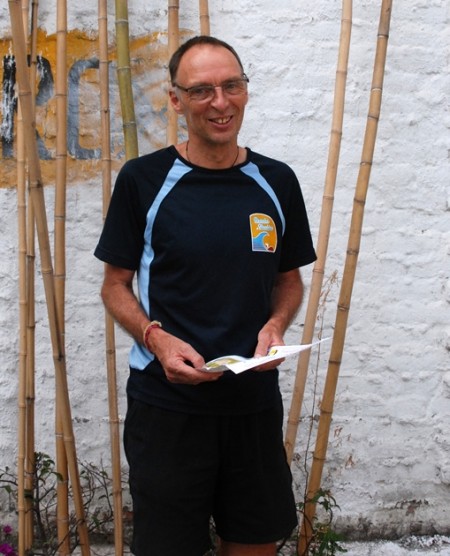
Paul Pacqué is the man behind The World Games orienteering maps. Pacqué comes originally from Belgium, but has lived for over 20 years in Australia. For The World Games maps he has been to Colombia three times during the past two years. “First I was here for about three weeks, then 10 days this spring, and now I have been here for the past month”, he tells.
He was supposed to get the base material for the maps from the Cali city council well in advance, but it took much longer than expected. At the end he was able to get good material for the sprint map, but for the middle map he only got aerial photos. Still, Pacqué says it was fun to map the terrains in Cali. He also says he was constantly approached by curious people asking him what he was doing. As he speaks some Spanish, he was able to tell them about mapping and orienteering. Most of the people had not heard of orienteering before, but there were also several who got very enthusiastic about the sport, and some who knew it already.
The terrains in Cali are in or near the city, in park-like areas. Pacqué says he never felt afraid when mapping: “When I first came here, they told me I would get an escort for safety reasons, a police man or similar. I refused immediately. No way I’m going to go mapping with someone following me!”
The maps will be first used tomorrow (Thursday) in the model event. After the Games, the maps will be given to the Colombian Orienteering Federation for further use.
For more information on The World Games, please visit: http://old.orienteering.org/events/?event_id=276 or http://worldgames2013.com.co/en/sports/trend-sports/orienteering.html
For start lists, online TV, results and tracking, please go to: http://wg2013.orienteering.org/
The World Games orienteering chat can be found here: http://old.orienteering.org/the-world-games-chat/
|| Print page ||Search
IOF Main Sponsor
IOF Sponsors
World Championships


Other Upcoming Events


IOF Partners


